Image caption
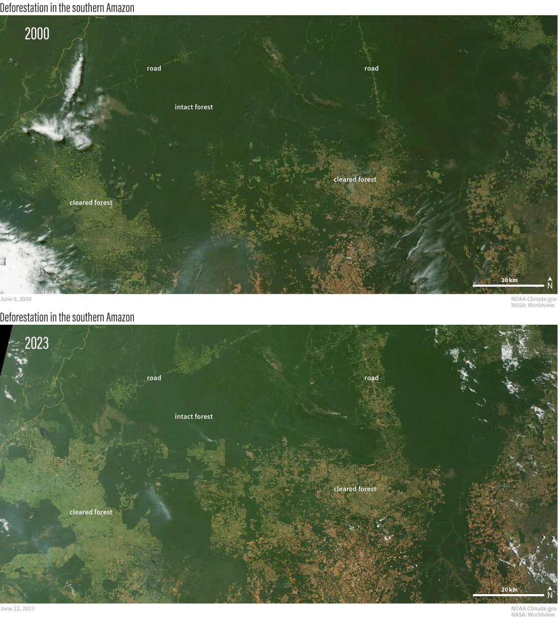
Deforestation in the southern Amazon River Basin in the past two decades. Photo-like satellite images from NASA's Terra satellite show the extent of intact forest (deep green) and cleared areas (light green and reddish brown) on June 9, 2000, and June 22, 2023. In the 23 years separating the images, significant new areas were cleared along the southern edges of the forest and along roads penetrating northward into the heart of the Amazon. NOAA Climate.gov image, based on NASA Terra satellite data from Worldview.