File name: Fire_fuel_ARC2020_620.jpg
Original Resolution: 620 × 700
File Size: 74 KB (MIME Type: image/jpeg)
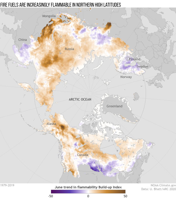
Rising surface temperatures have made fire fuels in Northern Hemisphere high latitudes more flammable over the past 40 years. This map shows the June trend (1979–2019) in the Build-up Index, an element of the Canadian Forest Fire Danger Rating System that uses weather data to estimate the dryness of fuels. Brown indicates increasing flammability; purple indicates decreasing flammability. NOAA Climate.gov map, adapted from the 2020 Arctic Report Card. Full story.