Image caption
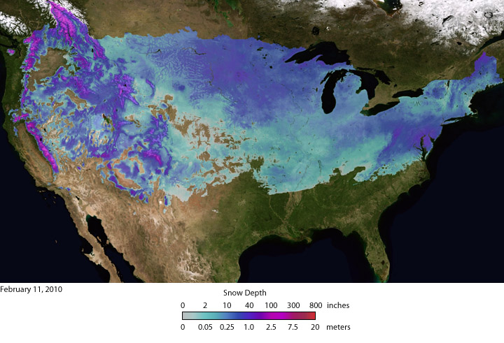
In early February, two weather systems brought record snowfalls to Washington, D.C. and other parts of the U.S. mid-Atlantic region. This image shows the depth of snow that had accumulated at locations across the contiguous United States as of February 11, 2010. Image by NOAA Environmental Visualization Laboratory using data courtesy of NOAA’s National Operational Hydrologic Remote Sensing Center.