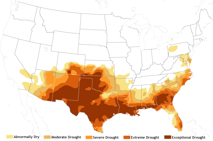
Image caption
Drought classification map for July 2011, showing exceptional drought conditions covering nearly 12 percent of the contiguous United States. The more severe the drought, the darker the red. Map by NOAA Climate.gov team, based on data from the U.S. Drought Monitor Project.