File name: arctic-antarctic-anim-mar-22-620.gif
Original Resolution: 620 × 842
File Size: 455 KB (MIME Type: image/gif)
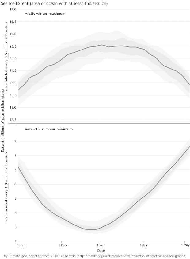
Sea ice extent for January 1 through May 5 for every year in the continuous sea ice satellite record (1979–2017) for Arctic (top) and Antarctic (bottom). Yearly extents are color-coded by decade: 1979–1989 (green), 1990s (blue-purple), 2000s (blue), and 2010s (pink). This animation is adapted from NSIDC’s Charctic interactive sea ice graph. Note that Arctic and Antarctic scales differ.